We arrived at the Georgia-North Carolina border on a GORGEOUS sunny afternoon! The occasion was marked by a wooden sign nailed to a tree and a crowd of hikers sitting alongside the trail cooking and eating lunch at the day's most important landmark.

When we continued up the trail, we discovered that North Carolina had a very straightforward way of getting over mountains. Straight up. Straight back down. Repeat. That was the first few miles anyway! Oddly enough, I discovered on a map later that almost as soon as we got into NC, we turned south and hiked back towards the Georgia line before actually heading north!
Once we got over the initial steep climbs in NC, the terrain settled down a bit! We camped that night at Standing Indian Shelter, just before Standing Indian Moutain, our first climb over 5,000 feet!
We woke to great weather after a slightly rainy night, and headed up the mountain. It was a surprisingly mild and fast hike to the top! We dropped our packs and took a side trail to the summit for the views and a snack!


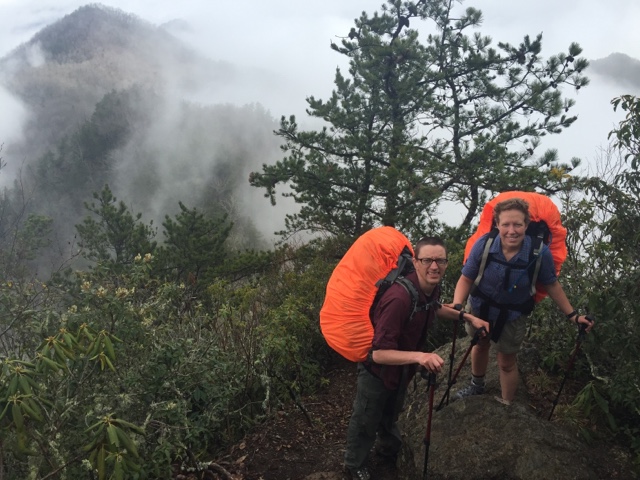
Even with fire and good company, Muskrat and I were beat once the sun dropped below the ridges. The next day we had the climb up Albert Mountain AND our 100 mile mark to think about! The views from the fire tower were rumored to be amazing!
We wouldn't know anything about that though, because we summited Albert, a steep rocky spike of a hike, in thick fog, wind, and rain. We did get enough cell signal there to book a rental car and a hotel room for Franklin the next day though, so it wasn't a total loss! Also, 100 MILES!! What a milestone!


We had planned to stop at Rock Gap Shelter that night, then push on to Winding Stair Gap in the morning to meet Enterprise and go into Franklin for boot assessments at Outdoor 76, laundry and resupply. We were down to 2 packets of oatmeal and 2 bullion cubes in our food supply! We ended up in a great conversation with a guy named Which Way, hiking with his wife and dad. He and his wife were married a week before we were. He was fast, and with the light load of no food, we kept up all the way to Rock Gap.
It was only 3:15 when we arrived, and we felt great, so we continued another four miles to a campsite just beyond Winding Stair. It made for a 16 mile day, our longest yet! Now, we would only have to walk a few tenths to get to our rental car pickup in the morning!
The big draw of Franklin is an outfitter, Outdoor 76. They are known as the boot specialists of the AT. People come to them with 110 miles worth of foot ailments from the trail, and they magically unite them with the right boots, insoles or shoes to keep them walking towards Maine. With Muskrat's foot pain continuing, and mine only moderately better, we were very excited to get there. Oh, and they have a craft beer bar IN the outfitter, so that's fun too!

When we hiked out to the parking lot at Winding Stair in the morning, there was a very sweet local guy with a breakfast spread on the tailgate of his pickup! He had coffee, orange juice, fresh fruit, and homemade banana bread!
We ate and chatted with him for awhile. We also called Enterprise to let them know that they could come get us early if at all possible! The trail angel was a great guy from Franklin who enjoys helping out the hikers with some good food now and then. We couldn't thank him enough.
The minutes ticked by, and shuttles from town and hotels came and went with hikers, and Enterprise was nowhere to be found. We called again, and they said that the guy was on the way, then that he might be lost. The trail angel offered us a ride down if they didn't show, and I wasn't going to turn it down! Finally, 40 minutes late, the Enterprise guy arrived in a black pickup and took us into town.
Enterprise gave us an upgrade to a Nissan Xterra, which we drive at home, to make up for being late to pick us up. Once we had the car, we rushed to check into the hotel, shower and hit the laundromat, which was conveniently located next to a bbq restaurant! We stuffed ourselves full of brisket and fries while we cleaned the hiker stink out of our clothes!
When we were finally in our freshly laundered town clothes, we headed to Outdoor 76 for what turned out to be a 4 hour shoe fitting! Muskrat got new insoles for his Asolos, and I was forced to retire my 11 year old Asolos. I mailed them home to my mom, and I left wearing a new pair of Salomons a full size and 1/3 bigger than my old boots. It turns out that I have really short toes, which make the overall length of my foot fit into a European 39, but from the heel to metatarsal heads, my foot is a size 41, so wearing a 39 crams the metatarsal heads into the toe box of a shoe, causing the pain I was feeling while hiking. Problem solved.

We ate dinner at an awesome restaurant just down the street from the outfitter called The Bowery. I highly recommend it, if you find yourself in Franklin, NC!

The one thing we hadn't gotten done was grocery shopping, so we decided to stay a second night. Also, we wanted to go to the hiker feed that Outdoor 76 was having the next afternoon!
In the morning, we went to the baptist church for pancakes and bacon, but we missed the pancakes, because the flyer we saw was unclear about the ending time. We did get bacon, coffee, orange juice and the opportunity to send a note and a photo to my mom!
We got our groceries, packed everything up, and headed to the cookout! We saw many hiker friends at the feed, and we stuffed ourselves with hot dogs, chips, sodas and beers.

That evening we walked across the street from our hotel with another hiker, Harley, and I put away enough salad for the next five days of hiking. . . Or so I thought! I was starving in the morning!

Back on the trail, we were aiming for a meadow with a stream and tent sites at Wine Spring, just a quick 9 miles ahead. First we climbed up Siler Bald! Our first Bald!! The AT skirts the summit, so we left our packs and hiked up the side trail to the views above!

We chatted with some other hikers at the foot of Silers Bald, and it sounded as if most people were heading for the meadow at Wine Spring, though some were contemplating staying right there because it was so beautiful.
We hiked on, and the trail paralleled a dirt road that we could see through the trees. There were more cars on it than I would have expected. I was feeling pretty beat by the time we climbed up to a road crossing with a piped spring next to the trail. I was telling Muskrat that the road might have trail magic! I was imagining all of the delicious foods I would want to eat before the steep half mile up to the meadow.
We popped out of the woods onto the road, and there were two hikers, Moonbow and Lightning Bug sitting by the spring. They told us a car had just stopped and had given them a ton of Starburst jelly beans, because it was Easter. They offered us the handfuls that remained, and we gladly ate them!
The four of us dragged our tired selves up the hill, fueled by the sugar rush. We found what appeared to be the side trail to the campsite, but there was no water source as promised in the guide, and the meadow was right on a road that led to some communication towers. It's advised that camping in view of roads can be dangerous, and we needed water. Lightning Bug and Moonbow decided to push on, and a few others who had joined us stood discussing what our best options were. The next shelter was another 3 miles, and it was after 5.
We, along with, Mac and Pace, decided to move on to that next shelter, which meant climbing Wayah Bald. I wish I had more jelly beans!
We hiked at a pace that was much faster than our normal pace, breathing more heavily than usual as we navigated the rocky trail. The climb up Wayah Bald wasn't as challenging as we had anticipated. In fact, some of it was paved, and there was a parking lot that people could hike walk from to visit the stone tower atop the bald. My mind turned to trail magic again!
The stone tower came into view, and there were tons of hikers gathered around a fire. There were coolers with string cheese, a guy cooking bacon, a gigantic bag full of Easter candy, and the makings of s'mores! With daylight slowly fading, and another mile to hike, we stopped and ate our fill! We took photos, enjoyed the company of other hikers and left with bellies full of bacon and sugar.


We did manage to make camp before dark, but we cooked, ate and cleaned up by headlamp. I found the very grateful hiker who belonged to the fleece and was happy to be reunited with both his jacket and the cough drops in the pocket of it! After the extra miles, it hardly mattered that our campsite was on an obvious incline.
The following day was rainy and mild, and we were headed for Wesser Bald Shelter, just 10.5 miles away. Along the way we discussed our plans for Nantahala Outdoor Center or "The NOC." We had called about rooms a few days ago, but were told they were full except for bunk space. We were unsure of tenting options in the immediate area, but we had to stop there long enough to get a box we had sent ourselves, purchase a canister of stove fuel, and partake in the pizza and beer at the restaurant. Seriously, hiker hunger is REAL.
We found a spot with signal, and called about the bunk room spots only to find out that they didn't provide linens and that wouldn't work with our one double wide sleeping bag, because men and women have separate bunk houses. The man in reservations offered us a room in a cabin that was being remodeled, and we jumped on it. Now we had a confirmed place to sleep at NOC!
The hike to Wesser was uneventful and soggy. The shelter and tenting areas were packed when we arrived to make camp, so we ended up on a tiny tilted spot of ground on a steep hill. Wet and chilled, we cooked at the shelter and talked with other hikers as we ate.
Warm and dry in our tent, we slept uncomfortably with gravity pulling us down into a corner of our tent. At least the next night, we would be in a bed.
The morning was foggy and damp, but the clouds were higher with the promise of an at least drier day than the previous. We were excited to go fast and get to the NOC quickly, as it was only about 6 miles away and all downhill.
Ugh. The downhill was 6 miles of rocky, rooted, muddy, slippery, narrow trail that required carefully placed steps. We were moving at a crawl. We could hear the river rushing below for the longest time, but it seemed like we would never get there. At least we had beautiful views!

The NOC is an outdoor playground where hikers, mountain bikers, and kayaker come to do their things! The Nantahala River runs right down the middle of the complex, which features a restaurant, bar, outfitter, general store, and accommodations ranging from a bunkhouse to private cabins. They do wilderness rescue training and all sorts of other classes there. It's a place we would love to visit again.
We did our laundry, hung our tent to dry, and met up with Mac and Pace and Mike and Jade, two couples we had been hanging with since day three at Hawk Mountain, for pizza and beer by the river. We put down three large pizzas and ordered desserts! We were joined by another friend from Hawk Mountain, The Gentleman, and Akeila, a woman from Belgium.
Once all of the food was gone, and hiker midnight was sneaking up on us, we said goodnight to each other and to the other hikers at other tables and headed for bed, because we had all seen the elevation profile for the next day, and it was going to be a hard one, climbing from 1749ft. to 4710ft. in about 6 miles.
In the morning, we packaged our bounce box to ship to Damascus, and packed our gear for the long uphill day. We went to the outfitter to get a hip pocket for my pack and a fuel canister. Then we planned to eat breakfast, buy a bomber of Nantahala Beer for the road (Muskrat promised to carry it, because he didn't get it before the general store closed the night before.), and head out!
That was when Winston and her friend Gutsy, who wasn't hiking, but was running support, having thru hiked years ago, approached us in the outfitter with an offer we couldn't refuse! Did we want to put our packs in Gutsy's van and slackpack to Stecoah Gap tonight, then do it again the next day all the way to Fontana Dam a day early!? YES!
No comments:
Post a Comment